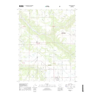
2019 Map of Norwood
USGS Topo · Published 2019About this map
Wrights Mesa and the surrounding high country define this landscape, where the settlement of Norwood serves as a central hub for ranching and recreation. The geography is deeply carved by the San Miguel River as it flows through the dramatic San Miguel Canyon, while a complex network of historic irrigation systems like Dearborn Ditch, Garley Ditch, and Nelson Ditch crisscross the plateau. This 2019 survey shows the area's agricultural reliance on water management, evidenced by numerous reservoirs and named ditches that feed the local ranchlands. To the north, the Uncompahgre National Forest covers the rising slopes toward Patterson Mtn, providing a stark contrast to the open flats near Coventry. Genealogists and local historians will find the Norwood Cem and family landmarks such as Williams Ranch Airport helpful for anchoring local records to the physical terrain of San Miguel County.
Find a feature on this map
58 named features on this map. Tap any name to fly to it.
Don’t see what you’re looking for? This feature index may not catch every label — zoom into the map to look around manually.
Map Details
Editions of this 2019 Norwood Map
This is the sole edition of this map. No revisions or reprints were ever made.
Other maps of this area

1956 · Moab
USGS Topo · 1:250,000

1959 · Moab
USGS Topo · 1:250,000

1960 · Moab
USGS Topo · 1:250,000

1962 · Moab
USGS Topo · 1:250,000

1964 · Moab
USGS Topo · 1:250,000
1964 · Redvale
USGS Topo · 1:24,000
1964 · Norwood
USGS Topo · 1:24,000
1964 · Gurley Canyon
USGS Topo · 1:24,000
1964 · Oak Hill
USGS Topo · 1:24,000
1964 · Barkelew Draw
USGS Topo · 1:24,000