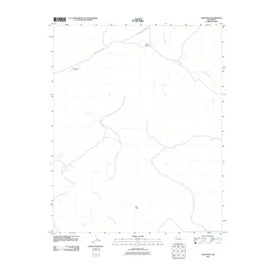
2010 Map of Nose Rock
USGS Topo · Published 2010About this map
Nose Rock rises as a prominent landmark in this high-desert portion of the Eastern Navajo Agency, defining a landscape shaped by drainage networks and service roads. The map illustrates the critical role of water infrastructure in this arid region, marking the locations of Windmill Number 5 and Windmill Number 6. These isolated water points serve as vital nodes within a terrain crisscrossed by the ephemeral paths of Kin Klizhin Wash and Kim-me-ni-oli Wash. Transport across the area is primarily facilitated by Indian Service Route 7030, which connects these remote outposts. The sparse settlement pattern and reliance on designated service routes reflect the specialized land management and traditional use within this section of New Mexico during the early 21st century.
Find a feature on this map
6 named features on this map. Tap any name to fly to it.
Don’t see what you’re looking for? This feature index may not catch every label — zoom into the map to look around manually.
Map Details
Editions of this 2010 Nose Rock Map
This is the sole edition of this map. No revisions or reprints were ever made.
Other maps of this area

1883 · Mt. Taylor
USGS Topo · 1:250,000

1886 · Wingate
USGS Topo · 1:250,000

1886 · Mt. Taylor
USGS Topo · 1:250,000

1889 · Largo
USGS Topo · 1:250,000

1889 · Chaco
USGS Topo · 1:250,000

1892 · Wingate
USGS Topo · 1:250,000

1892 · Chaco
USGS Topo · 1:250,000

1892 · Mt. Taylor
USGS Topo · 1:250,000

1895 · Largo
USGS Topo · 1:250,000

1899 · Mt. Taylor
USGS Topo · 1:250,000