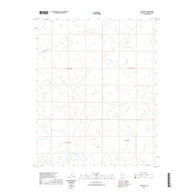
2020 Map of Nose Rock
USGS Topo · Published 2020About this map
Nose Rock rises as a prominent landmark in this high-desert region of the Eastern Navajo Agency, where the landscape is defined by the drainage patterns of seasonal watercourses. The network of the Kin Klizhin Wash and Kim-me-ni-oli Wash cut through the terrain, illustrating the hydrologic character of the San Juan Basin. The map details the remote transition between the public land survey townships of t20n r12w and t19n r11w, showing the sparsely developed infrastructure characteristic of this portion of New Mexico. Local travel is tied to the South Kin Bineola Road, which provides the primary access through the arid mesas and alluvial plains. This survey offers a clear view of the land's topography before more modern development, preserving the exact placement of named geographical features essential for understanding the area's spatial history.
Find a feature on this map
8 named features on this map. Tap any name to fly to it.
Don’t see what you’re looking for? This feature index may not catch every label — zoom into the map to look around manually.
Map Details
Editions of this 2020 Nose Rock Map
This is the sole edition of this map. No revisions or reprints were ever made.
Other maps of this area

1883 · Mt. Taylor
USGS Topo · 1:250,000

1886 · Wingate
USGS Topo · 1:250,000

1886 · Mt. Taylor
USGS Topo · 1:250,000

1889 · Largo
USGS Topo · 1:250,000

1889 · Chaco
USGS Topo · 1:250,000

1892 · Wingate
USGS Topo · 1:250,000

1892 · Chaco
USGS Topo · 1:250,000

1892 · Mt. Taylor
USGS Topo · 1:250,000

1895 · Largo
USGS Topo · 1:250,000

1899 · Mt. Taylor
USGS Topo · 1:250,000