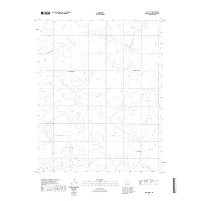
2023 Map of Nose Rock
USGS Topo · Published 2023About this map
Kim-me-ni-oli Wash and Kin Klizhin Wash define the drainage patterns of this high desert landscape in McKinley County. The map area is primarily organized by the Public Land Survey System, showing the transitions between t20n r12w, t20n r11w, t19n r12w, and t19n r11w. This layout highlights the rural, undeveloped character of the region as it appeared in the early 21st century. The only significant named transportation route is the South-Kin Bineola Road, which cuts across the northwestern portion of the sheet. The terrain is marked by seasonal watercourses and desert topography, illustrating the sparse infrastructure typical of this part of New Mexico.
Find a feature on this map
7 named features on this map. Tap any name to fly to it.
Don’t see what you’re looking for? This feature index may not catch every label — zoom into the map to look around manually.
Map Details
Editions of this 2023 Nose Rock Map
This is the sole edition of this map. No revisions or reprints were ever made.
Other maps of this area

1883 · Mt. Taylor
USGS Topo · 1:250,000

1886 · Wingate
USGS Topo · 1:250,000

1886 · Mt. Taylor
USGS Topo · 1:250,000

1889 · Largo
USGS Topo · 1:250,000

1889 · Chaco
USGS Topo · 1:250,000

1892 · Wingate
USGS Topo · 1:250,000

1892 · Chaco
USGS Topo · 1:250,000

1892 · Mt. Taylor
USGS Topo · 1:250,000

1895 · Largo
USGS Topo · 1:250,000

1899 · Mt. Taylor
USGS Topo · 1:250,000