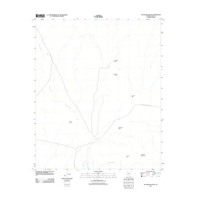
2011 Map of Nottbusch Butte
USGS Topo · Published 2011About this map
Cemetery Ridge and Nottbusch Butte dominate this section of the Arizona desert, where dry watercourses define the movement of water and livestock. The landscape is marked by the expansive Nottbusch Valley and the southern reaches of the Gila Bend Mountains, illustrating a classic southwestern basin and range topography. Arid land management is evidenced by features like Road Tank, while the hydrological network is centered on the braided channels of Deadman Wash and Nottbusch Wash. Historical travel through this corner of Yuma County is dictated by the passage between the Clanton Hills and Clanton Hill, with routes such as Palomas Harquahala Rd and Arlington-Clanton Well Rd following the natural contours of the desert floor.
Find a feature on this map
12 named features on this map. Tap any name to fly to it.
Don’t see what you’re looking for? This feature index may not catch every label — zoom into the map to look around manually.
Map Details
Editions of this 2011 Nottbusch Butte Map
This is the sole edition of this map. No revisions or reprints were ever made.
Other maps of this area

1927 · Hyder
USGS Topo · 1:62,500

1930 · Hyder
USGS Topo · 1:62,500

1942 · Vicksburg
USGS Topo · 1:250,000

1954 · Phoenix
USGS Topo · 1:250,000

1957 · Phoenix
USGS Topo · 1:250,000

1958 · Phoenix
USGS Topo · 1:250,000

1960 · Phoenix
USGS Topo · 1:250,000

1962 · Little Horn Mts
USGS Topo · 1:62,500

1962 · Eagletail Mts
USGS Topo · 1:62,500
1964 · Hyder NE
USGS Topo · 1:24,000