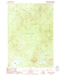
1988 Map of Number Four Mtn.
USGS Topo · Published 1988About this map
Number Four Mtn and Elephant Mountain dominate this heavily forested landscape in the Moosehead Lake region of the late 1980s. The area is defined by a complex network of glacial ponds and drainages, including the expansive Upper Wilson Pond and the smaller, more isolated Horseshoe Pond. The map covers several large land grants and townships such as Bowdoin College Grant West and Beaver Cove, reflecting the historical timber-management and institutional land ownership patterns of the Maine Woods. A dense network of unimproved roads and trails weaves through the drainages of North Lily Bay Brook and Baker Brook, indicating the ongoing importance of logging and recreational access. Distinctive peaks like Baker Mtn and Lily Bay Mtn rise above the intervales, providing a clear topographic record of this wilderness tract before further modern development or road expansion.
Find a feature on this map
31 named features on this map. Tap any name to fly to it.
Don’t see what you’re looking for? This feature index may not catch every label — zoom into the map to look around manually.
Map Details
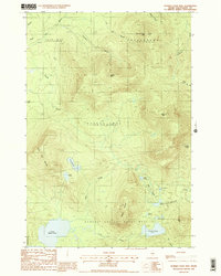
Editions of this 1988 Number Four Mtn. Map
2 editions found
Other maps of this area

1920 · Moosehead Lake
USGS Topo · 1:62,500

1922 · Moosehead Lake
USGS Topo · 1:62,500

1930 · Moosehead Lake
USGS Topo · 1:62,500

1944 · Moosehead Lake
USGS Topo · 1:62,500

1950 · Sebec Lake
USGS Topo · 1:62,500

1951 · Greenville
USGS Topo · 1:62,500

1952 · First Roach Pond
USGS Topo · 1:62,500

1954 · Millinocket
USGS Topo · 1:250,000

1957 · Moosehead Lake
USGS Topo · 1:62,500

1958 · Millinocket
USGS Topo · 1:250,000
Featured Places
- Greenville, ME
- Beaver Cove, ME
- Lily Bay Township, ME
- Bowdoin College Grant West Township, ME
- Frenchtown Township, ME