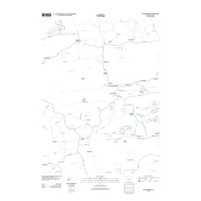
2013 Map of Nuremberg
USGS Topo · Published 2013About this map
Gowen Breaker Station stands as a focal point of industrial infrastructure in this pocket of Columbia County, reflecting the deep-seated coal heritage of the region. The landscape is defined by the high elevations of Buck Mountain and South Buck Mountain, which channel numerous waterways like Black Cr and Falls Run. This 2013 survey illustrates a dense network of small settlements and neighborhood clusters including Nuremberg, Gowen, and Fern Glen, which are tightly packed compared to the more dispersed rural reaches of Mountain Grove and Zion Grove. To the south, the winding course of Catawissa Cr and the presence of Mc Donald's Airport highlight the mix of natural topography and modern utility. The transition from industrial sites to leisure areas is marked by the Sugarloaf Golf Course and the residential subdivisions near Sugarloaf Cr, providing a clear view of local land use at the start of the 2010s.
Find a feature on this map
148 named features on this map. Tap any name to fly to it.
Don’t see what you’re looking for? This feature index may not catch every label — zoom into the map to look around manually.
Map Details
Editions of this 2013 Nuremberg Map
This is the sole edition of this map. No revisions or reprints were ever made.
Other maps of this area

1889 · Catawissa
USGS Topo · 1:62,500

1892 · Catawissa
USGS Topo · 1:62,500

1892 · Mahanoy
USGS Topo · 1:62,500

1893 · Mahanoy
USGS Topo · 1:62,500

1894 · Catawissa
USGS Topo · 1:62,500

1894 · Shickshinny
USGS Topo · 1:62,500

1894 · Bloomsburg
USGS Topo · 1:62,500

1946 · Sybertsville
USGS Topo · 1:31,680

1946 · Berwick
USGS Topo · 1:31,680

1947 · Ashland
USGS Topo · 1:24,000
Featured Places
- Monticello, Beaver Township
- Gowen, Black Creek Township
- Gum Run, Black Creek Township
- Sugarloaf Township, PA
- Gowen Breaker Station, Black Creek Township