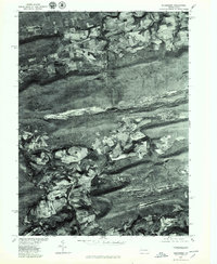
1976 Map of Nuremberg
USGS Topo · Published 1979About this map
Nuremberg and Weston occupy a central valley corridor in this orthophotoquad, captured through aerial photography in the mid-1970s. The landscape is defined by the heavy texture of the anthracite region, where the ridge of Buck Mountain separates the valley from the northern plateaus. To the south, Green Mountain frames the winding path of Catawissa Creek and the small settlement of Zion Grove. Unlike traditional topographic maps, this imagery reveals the specific land use patterns of the era, from the geometric patterns of upland agriculture to the visible scars of industrial activity along Black Creek and near Rock Glen. The contrast between the dense forest cover on the steep mountain slopes and the developed valley floor provides a clear look at the human footprint within the natural drainage basins of the Nescopeck Creek watershed.
Find a feature on this map
9 named features on this map. Tap any name to fly to it.
Don’t see what you’re looking for? This feature index may not catch every label — zoom into the map to look around manually.
Map Details
Editions of this 1976 Nuremberg Map
This is the sole edition of this map. No revisions or reprints were ever made.
Other maps of this area

1889 · Catawissa
USGS Topo · 1:62,500

1892 · Catawissa
USGS Topo · 1:62,500

1892 · Mahanoy
USGS Topo · 1:62,500

1893 · Mahanoy
USGS Topo · 1:62,500

1894 · Catawissa
USGS Topo · 1:62,500

1894 · Shickshinny
USGS Topo · 1:62,500

1894 · Bloomsburg
USGS Topo · 1:62,500

1946 · Sybertsville
USGS Topo · 1:31,680

1946 · Berwick
USGS Topo · 1:31,680

1947 · Ashland
USGS Topo · 1:24,000
Featured Places
- North Union Township, PA
- Beaver Township, PA
- Black Creek Township, PA
- Fern Glen, Black Creek Township
- Sugarloaf Township, PA