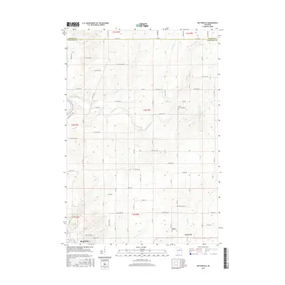
2015 Map of Nutterville
USGS Topo · Published 2015About this map
Nutterville and the northern outskirts of Wausau anchor this survey of the central Wisconsin landscape, where the Lincoln and Marathon county lines meet. The terrain is defined by a dense network of tributaries feeding into the Trappe River and its smaller counterpart, the Little Trappe River. This area shows a transition from the urban influence of Wausau in the south to a more dispersed rural pattern further north, with local landmarks like Chiber Cem and Mechanic Ridge Cem providing significant points of interest for genealogical research.
Find a feature on this map
72 named features on this map. Tap any name to fly to it.
Don’t see what you’re looking for? This feature index may not catch every label — zoom into the map to look around manually.
Map Details
Editions of this 2015 Nutterville Map
This is the sole edition of this map. No revisions or reprints were ever made.
Other maps of this area

1899 · Wausau
USGS Topo · 1:125,000

1902 · Wausau
USGS Topo · 1:125,000

1951 · Doering
USGS Topo · 1:48,000

1951 · Merrill
USGS Topo · 1:48,000

1953 · Wausau
USGS Topo · 1:48,000

1953 · Hatley
USGS Topo · 1:48,000

1954 · Iron Mountain
USGS Topo · 1:250,000

1955 · Green Bay
USGS Topo · 1:250,000

1959 · Iron Mountain
USGS Topo · 1:250,000

1963 · Wausau West
USGS Topo · 1:24,000