
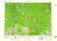
1959 Map of Iron Mountain
USGS Topo · Published 1959About this map
Rhinelander and the industrial hub of Iron Mountain anchor this late-1950s survey of the northern Wisconsin lake country and Michigan's Upper Peninsula border. The landscape is a complex network of glacial water bodies, featuring prominent names like Trout Lake, Fence Lake, and Pelican Lake, interspersed with managed timberlands including the American Legion State Forest and the vast Nicolet National Forest. Large tribal lands, such as the Lac du Flambeau Indian Reservation and Menominee Indian Reservation, define significant portions of the geography.
Find a feature on this map
164 named features on this map. Tap any name to fly to it.
Don’t see what you’re looking for? This feature index may not catch every label — zoom into the map to look around manually.
Map Details
Editions of this 1959 Iron Mountain Map
2 editions found
Other maps of this area

1898 · Iron River
USGS Topo · 1:62,500

1899 · Sagola
USGS Topo · 1:62,500

1899 · Crystal Falls
USGS Topo · 1:62,500

1899 · Wausau
USGS Topo · 1:125,000

1902 · Wausau
USGS Topo · 1:125,000

1902 · Marathon
USGS Topo · 1:125,000

1928 · Three Lakes
USGS Topo · 1:48,000

1930 · Robbins
USGS Topo · 1:48,000

1938 · Phelps
USGS Topo · 1:48,000

1938 · Minocqua
USGS Topo · 1:48,000