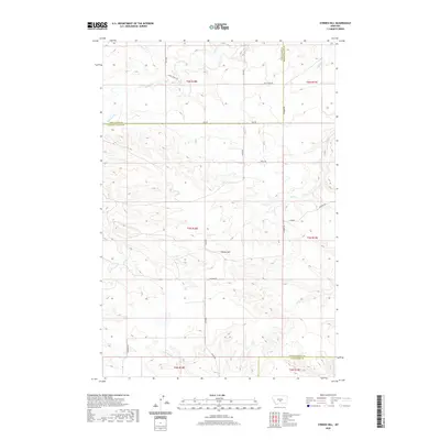
2020 Map of O'Brien Hill
USGS Topo · Published 2020About this map
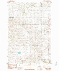
O'Brien Hill rises as a central landmark in this high-plains landscape where the borders of Wheatland, Golden Valley, and Stillwater counties meet. The drainage pattern here is defined by several seasonal watercourses, including Fish Cr and Simmons Cr in the northern reaches, and Van Winkle Cr to the south. This 2020 survey illustrates a sparsely populated ranching or agricultural region characterized by a section-line road network. Vital transit routes such as S Barber Rd and Seig Rd provide access through the undulating terrain, while the Windy Ridge Trl suggests a more primitive path following the natural contours of the land. The map serves as a precise record of modern land divisions and rural infrastructure, documenting the intersection of township boundaries like T5N R18E and T5N R19E amidst the expansive Montana range.
Find a feature on this map
20 named features on this map. Tap any name to fly to it.
Don’t see what you’re looking for? This feature index may not catch every label — zoom into the map to look around manually.
Map Details
Editions of this 2020 O'Brien Hill Map
This is the sole edition of this map. No revisions or reprints were ever made.
Other maps of this area

1889 · Big Snowy Mountain
USGS Topo · 1:250,000

1893 · Big Snowy Mountain
USGS Topo · 1:250,000

1954 · Roundup
USGS Topo · 1:250,000

1958 · Roundup
USGS Topo · 1:250,000
1985 · Locomotive Butte
USGS Topo · 1:24,000
1985 · Locomotive Butte SW
USGS Topo · 1:24,000
1985 · Locomotive Butte SE
USGS Topo · 1:24,000

1985 · Progress
USGS Topo · 1:24,000
1985 · O'Brien Hill
USGS Topo · 1:24,000
1985 · Gibson
USGS Topo · 1:24,000