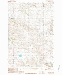
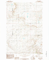
1985 Map of O'Brien Hill
USGS Topo · Published 1985About this map
O'Brien Hill dominates the central landscape of this high plains region, situated where the borders of several Montana counties converge. Compiled from 1977 aerial photography, the map reveals a rugged drainage network defined by the paths of Fish Creek, Rock Creek, and Simmons Creek. In the southern reaches, the winding course of Van Winkle Creek cuts through the terrain near the junction of Golden Valley and Stillwater counties. This provisional edition is characterized by its focus on topographic detail and water distribution across the ranching country, noting the precise location of numerous wells and springs that are vital to this semi-arid environment. The absence of major settlements highlights the land's utility for resource extraction and grazing during the late twentieth century.
Find a feature on this map
7 named features on this map. Tap any name to fly to it.
Don’t see what you’re looking for? This feature index may not catch every label — zoom into the map to look around manually.
Map Details
Editions of this 1985 O'Brien Hill Map
This is the sole edition of this map. No revisions or reprints were ever made.
Other maps of this area

1889 · Big Snowy Mountain
USGS Topo · 1:250,000

1893 · Big Snowy Mountain
USGS Topo · 1:250,000

1954 · Roundup
USGS Topo · 1:250,000

1958 · Roundup
USGS Topo · 1:250,000
1985 · Locomotive Butte
USGS Topo · 1:24,000
1985 · Locomotive Butte SW
USGS Topo · 1:24,000
1985 · Locomotive Butte SE
USGS Topo · 1:24,000

1985 · Progress
USGS Topo · 1:24,000
1985 · Gibson
USGS Topo · 1:24,000

1986 · Ryegate West
USGS Topo · 1:24,000