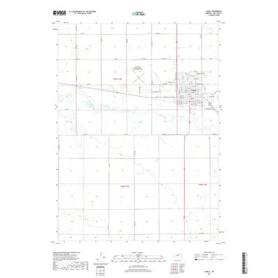
2017 Map of O'Neill
USGS Topo · Published 2017About this map
O'Neill serves as the focal point of this Holt County landscape, positioned at a vital crossroads just north of the Elkhorn River. The town's grid is meticulously detailed, showing a residential and commercial core expanding toward the The O'Neill Municipal Airport-John L Baker Field to the west. Local names like Sale Barn Rd and Vet Clinic Rd reflect the enduring agricultural and livestock economy of this Nebraska region.
Find a feature on this map
34 named features on this map. Tap any name to fly to it.
Don’t see what you’re looking for? This feature index may not catch every label — zoom into the map to look around manually.
Map Details
Editions of this 2017 O'Neill Map
This is the sole edition of this map. No revisions or reprints were ever made.
Other maps of this area

1954 · Atkinson SE
USGS Topo · 1:24,000

1954 · Opportunity
USGS Topo · 1:24,000

1954 · Meek SW
USGS Topo · 1:24,000

1955 · O'Neill
USGS Topo · 1:250,000

1958 · O'Neill
USGS Topo · 1:24,000

1958 · Inman
USGS Topo · 1:24,000

1959 · O'Neill
USGS Topo · 1:250,000

1964 · O'Neill SE
USGS Topo · 1:24,000

1964 · Emmet SE
USGS Topo · 1:24,000

1964 · O'Neill SW
USGS Topo · 1:24,000