
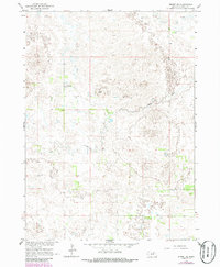
1964 Map of Emmet SE
USGS Topo · Published 1965About this map
Emmet, Grattan, and Fairview townships meet in this mid-1960s study of Holt County, which captures a landscape defined by traditional cattle ranching and prairie water management. The area is characterized by a high concentration of wetlands and depressions, requiring the use of features like the Flowing Well to support livestock in this sandhills environment. The settlement of Schaffer serves as a small local landmark within the township grid, while the presence of a Claypit in the southeastern portion suggests localized resource extraction for building materials or road work. Meandering through the center of the sheet, Dry Creek provides the primary drainage for the surrounding basins in Shamrock and Chambers. The map reflects a period before intensive center-pivot irrigation would significantly alter the visible surface of Nebraska's rangelands.
Find a feature on this map
9 named features on this map. Tap any name to fly to it.
Don’t see what you’re looking for? This feature index may not catch every label — zoom into the map to look around manually.
Map Details
Editions of this 1964 Emmet SE Map
2 editions found
Other maps of this area

1955 · O'Neill
USGS Topo · 1:250,000

1958 · O'Neill
USGS Topo · 1:24,000

1959 · O'Neill
USGS Topo · 1:250,000

1964 · Emmet NW
USGS Topo · 1:24,000

1964 · Emmet SW
USGS Topo · 1:24,000

1964 · O'Neill SW
USGS Topo · 1:24,000

1964 · Emmet
USGS Topo · 1:24,000

1969 · O'Neill
USGS Topo · 1:250,000

1981 · Amelia
USGS Topo · 1:24,000

1981 · Chambers East
USGS Topo · 1:24,000