
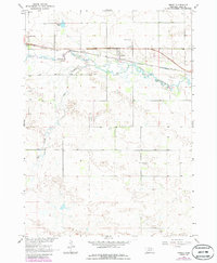
1964 Map of Emmet
USGS Topo · Published 1965About this map
The Elkhorn River meanders across this mid-century landscape, defining the character of northern Nebraska as it passes the small settlement of Emmet. This 1964 survey captures a moment when the Chicago and North Western railroad still served as a primary transportation artery through Holt and Grattan townships. The local infrastructure of the era is remarkably well-documented, showing the locations of rural schoolhouses such as School No 76 and School No 141, as well as the Wesleyan Campground near the riverbank.
Find a feature on this map
12 named features on this map. Tap any name to fly to it.
Don’t see what you’re looking for? This feature index may not catch every label — zoom into the map to look around manually.
Map Details
Editions of this 1964 Emmet Map
2 editions found
Other maps of this area

1954 · Atkinson SE
USGS Topo · 1:24,000

1954 · Atkinson
USGS Topo · 1:24,000

1954 · Meek SW
USGS Topo · 1:24,000

1955 · O'Neill
USGS Topo · 1:250,000

1958 · O'Neill
USGS Topo · 1:24,000

1959 · O'Neill
USGS Topo · 1:250,000

1964 · Emmet NW
USGS Topo · 1:24,000

1964 · Emmet SE
USGS Topo · 1:24,000

1964 · Emmet SW
USGS Topo · 1:24,000

1964 · O'Neill SW
USGS Topo · 1:24,000