
1964 Map of Emmet SW
USGS Topo · Published 1965About this map
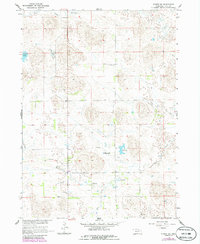
Holt Creek and a network of small, isolated lakes define this section of the Nebraska sandhills in the mid-1960s. The landscape is marked by a sparse settlement pattern characteristic of high-plains ranching, organized into the townships of Sheridan, Fairview, Wyoming, and Chambers. Scattered throughout this terrain are numerous Flowing Wells, indicating the critical reliance on groundwater for the cattle operations that shaped the local economy. The presence of School No 231 suggests a once-active rural school district serving the surrounding homesteads. Water features such as Lizard Lake, West Lake, East Lake, and Gold Lake provide rare landmarks in a region dominated by stabilized dunes and seasonal drainages like Dry Creek. This map captures a specific era of land management in the Missouri River Basin prior to further consolidation of rural infrastructure.
Find a feature on this map
12 named features on this map. Tap any name to fly to it.
Don’t see what you’re looking for? This feature index may not catch every label — zoom into the map to look around manually.
Map Details
Editions of this 1964 Emmet SW Map
2 editions found
Other maps of this area

1955 · O'Neill
USGS Topo · 1:250,000

1959 · O'Neill
USGS Topo · 1:250,000

1964 · Emmet NW
USGS Topo · 1:24,000

1964 · Emmet SE
USGS Topo · 1:24,000

1964 · Emmet
USGS Topo · 1:24,000

1969 · O'Neill
USGS Topo · 1:250,000

1981 · Swan Lake
USGS Topo · 1:24,000

1981 · Amelia
USGS Topo · 1:24,000
1981 · Chambers West
USGS Topo · 1:24,000
1982 · Cottonwood Lake
USGS Topo · 1:24,000