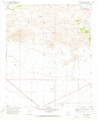
1969 Map of O'Neill Pass
USGS Topo · Published 1972About this map
The Date Creek Mountains dominate this 1960s landscape, where cattle ranching and transportation infrastructure intersect in the high desert of Yavapai County. Water management is the primary evidence of human activity, represented by numerous family-named improvements such as Hog Ranch Well, Newhall Well, and Henderson Tank. In the south, a remote Landing Strip and Fuel Tank sit near the valley floor, suggesting the use of aircraft for managing large rangelands. The rugged terrain is navigated by a network of primitive Jeep Trails and Pack Trails that converge near O'Neill Pass. Near the northern boundary, the Atchison Topeka and Santa Fe railroad corridor follows the drainage of South Fork Date Creek, providing a vital industrial link through this sparsely populated cattle country.
Find a feature on this map
26 named features on this map. Tap any name to fly to it.
Don’t see what you’re looking for? This feature index may not catch every label — zoom into the map to look around manually.
Map Details
Editions of this 1969 O'Neill Pass Map
This is the sole edition of this map. No revisions or reprints were ever made.
Other maps of this area

1887 · Prescott
USGS Topo · 1:250,000

1892 · Prescott
USGS Topo · 1:250,000

1903 · Congress
USGS Topo · 1:125,000

1904 · Congress
USGS Topo · 1:125,000

1923 · Signal
USGS Topo · 1:250,000

1942 · Signal
USGS Topo · 1:250,000

1950 · Prescott
USGS Topo · 1:250,000

1954 · Prescott
USGS Topo · 1:250,000

1958 · Prescott
USGS Topo · 1:250,000

1959 · Prescott
USGS Topo · 1:250,000