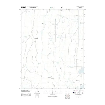
2011 Map of Oak Hill
USGS Topo · Published 2011About this map
Wrights Mesa and the surrounding high country of San Miguel County are defined by a complex network of irrigation and water storage. This landscape features numerous artificial water bodies including Burn Canyon Reservoir, Williams Reservoir, and Gurley Reservoir, which support the local ranching economy. The Japanese Ditch and various laterals, such as the Hill and Tracey Lateral, demonstrate the intensive engineering required to manage water across the arid terrain.
Find a feature on this map
64 named features on this map. Tap any name to fly to it.
Don’t see what you’re looking for? This feature index may not catch every label — zoom into the map to look around manually.
Map Details
Editions of this 2011 Oak Hill Map
This is the sole edition of this map. No revisions or reprints were ever made.
Other maps of this area

1956 · Cortez
USGS Topo · 1:250,000

1956 · Moab
USGS Topo · 1:250,000

1958 · Cortez
USGS Topo · 1:250,000

1959 · Cortez
USGS Topo · 1:250,000

1959 · Moab
USGS Topo · 1:250,000

1960 · Moab
USGS Topo · 1:250,000

1962 · Moab
USGS Topo · 1:250,000

1962 · Cortez
USGS Topo · 1:250,000

1964 · Moab
USGS Topo · 1:250,000
1964 · Lone Cone
USGS Topo · 1:24,000