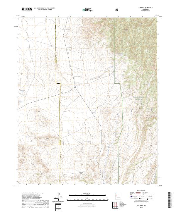
2023 Map of Oak Peak
USGS Topo · Published 2023About this map
Oak Peak rises as the central topographical anchor for this high-altitude landscape along the border of Catron and Socorro counties. The map documents a terrain defined by its water management systems, featuring a series of named tanks and catchments such as Deep Well Tank, Oak Springs Tank, and Hunt Tank that suggest the area's importance for livestock or wildlife. Land use is divided between the protected bounds of the Cibola National Forest to the east and open range to the west, separated by the north-south passage of Forest Rd 477. Historical naming conventions are evident in features like Lost Mines Hill and Sullivans Hole, hinting at past prospecting and early ranching ventures. The drainage patterns of Alamosa Creek and the deep cuts of Baney Canyon and Limestone Canyon illustrate the complex watershed that flows through this corner of New Mexico.
Find a feature on this map
28 named features on this map. Tap any name to fly to it.
Don’t see what you’re looking for? This feature index may not catch every label — zoom into the map to look around manually.
Map Details
Editions of this 2023 Oak Peak Map
This is the sole edition of this map. No revisions or reprints were ever made.
Other maps of this area

1954 · Tularosa
USGS Topo · 1:250,000

1958 · Tularosa
USGS Topo · 1:250,000

1964 · Welty Hill
USGS Topo · 1:24,000

1964 · Bay Buck Peaks
USGS Topo · 1:24,000

1964 · Monica Saddle
USGS Topo · 1:24,000

1965 · Oak Peak
USGS Topo · 1:24,000
1965 · Kellog Well
USGS Topo · 1:24,000

1965 · Dusty
USGS Topo · 1:24,000

1979 · San Mateo Mountains
USGS Topo · 1:100,000
1981 · Luera Mountains East
USGS Topo · 1:24,000