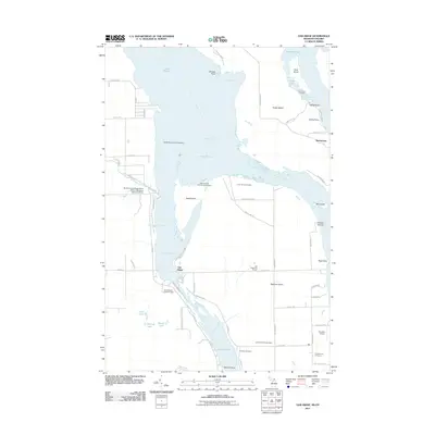
2011 Map of Oak Ridge
USGS Topo · Published 2011About this map
Saint Marys River serves as the central artery for this international border region, where the intricate channels of Lake Huron separate large landmasses. The map highlights the complex navigational systems required for the Great Lakes waterway, including the West Neebish Channel Range, Middle Neebish Channel Range, and Lower Nicolet Ranges. On land, the settlement of Oak Ridge sits near the western shore, while Homestead occupies a position on the eastern side of Sugar Island. The landscape is a mix of academic research at the Dunbar Forest Experiment Station Michigan State University and local community landmarks. Researchers can identify several faith-based and lineage sites, such as the Laitinen Family Cemetery, Catholic Cemetery, and Presbyterian Cemetery, which speak to the area's genealogical history along the river's edge.
Find a feature on this map
70 named features on this map. Tap any name to fly to it.
Don’t see what you’re looking for? This feature index may not catch every label — zoom into the map to look around manually.
Map Details
Editions of this 2011 Oak Ridge Map
This is the sole edition of this map. No revisions or reprints were ever made.
Other maps of this area

1913 · Sault Sainte Marie
USGS Topo · 1:62,500

1919 · Neebish
USGS Topo · 1:62,500

1941 · Neebish
USGS Topo · 1:63,360

1941 · Sault Sainte Marie
USGS Topo · 1:63,360

1951 · Barbeau
USGS Topo · 1:24,000

1951 · Baie De Wasai
USGS Topo · 1:24,000

1951 · Oak Ridge
USGS Topo · 1:24,000

1951 · Sault Ste. Marie
USGS Topo · 1:62,500

1951 · Sault Ste. Marie South
USGS Topo · 1:24,000

1951 · Lake George
USGS Topo · 1:62,500