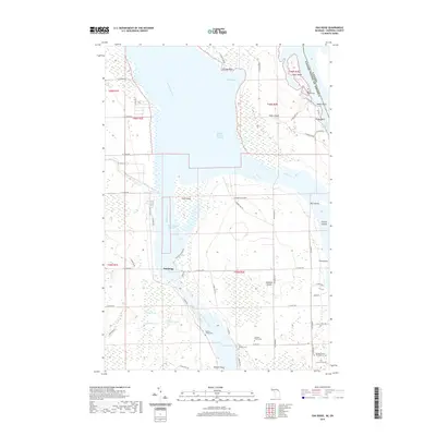
2019 Map of Oak Ridge
USGS Topo · Published 2019About this map
The Saint Marys River serves as the international boundary between the United States and Canada, defining the complex island geography of this northern borderland. On the western shore, the small settlement of Oak Ridge sits near the West Neebish Channel, an area marked by a intricate network of river channels including the Middle Neebish Channel and East Neebish Channel. The landscape is dominated by large riverine islands like Sugar Island and Neebish Island, which are dotted with numerous small family and community burial sites. Genealogists can find localized historical records through the Haynes Family Cem, Laitinen Family Cem, and the Duck Island Cem. The terrain inland from Sawmill Point and Shingle Point is a mosaic of wetlands and small lakes, such as Deer Lake and Muskrat Lake, connected by rural routes like S Scenic Dr and E Range Light Row.
Find a feature on this map
63 named features on this map. Tap any name to fly to it.
Don’t see what you’re looking for? This feature index may not catch every label — zoom into the map to look around manually.
Map Details
Editions of this 2019 Oak Ridge Map
This is the sole edition of this map. No revisions or reprints were ever made.
Other maps of this area

1913 · Sault Sainte Marie
USGS Topo · 1:62,500

1919 · Neebish
USGS Topo · 1:62,500

1941 · Neebish
USGS Topo · 1:63,360

1941 · Sault Sainte Marie
USGS Topo · 1:63,360

1951 · Barbeau
USGS Topo · 1:24,000

1951 · Baie De Wasai
USGS Topo · 1:24,000

1951 · Oak Ridge
USGS Topo · 1:24,000

1951 · Sault Ste. Marie
USGS Topo · 1:62,500

1951 · Sault Ste. Marie South
USGS Topo · 1:24,000

1951 · Lake George
USGS Topo · 1:62,500