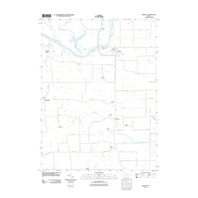
2012 Map of Oakville
USGS Topo · Published 2012About this map
The Iowa River carves a winding path through this corner of Louisa County, defining a landscape of complex wetlands and agricultural drainage. Low-lying areas near the river are marked by distinct water bodies including Sunfish Lake, Halls Lake, and Spitznogle Lake, while a network of engineered waterways like the Hawkeye-Dolbee Diversion Channel and County Line Ditch manage the fertile plains. The settlement of Oakville serves as a local hub, home to the Oakville Post Office, while the surrounding countryside preserves its history through numerous rural burial grounds. Genealogists and local historians will find significant value in the distribution of family-named landmarks and cemeteries, from the Old Swedish Cemetery in the south to the Parson Cemetery near the river, reflecting the deep-rooted community ties of the Northfield and Huron areas.
Find a feature on this map
70 named features on this map. Tap any name to fly to it.
Don’t see what you’re looking for? This feature index may not catch every label — zoom into the map to look around manually.
Map Details
Editions of this 2012 Oakville Map
This is the sole edition of this map. No revisions or reprints were ever made.
Other maps of this area

1934 · Oquawka
USGS Topo · 1:48,000

1934 · Burlington
USGS Topo · 1:48,000

1935 · Keithsburg
USGS Topo · 1:48,000

1940 · Oquawka
USGS Topo · 1:62,500

1940 · Burlington
USGS Topo · 1:62,500

1941 · Keithsburg
USGS Topo · 1:62,500

1946 · Wapello
USGS Topo · 1:62,500

1949 · Wapello
USGS Topo · 1:62,500

1953 · Toolesboro
USGS Topo · 1:24,000
1953 · Joy
USGS Topo · 1:24,000