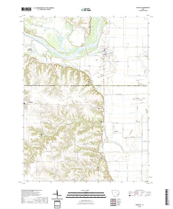
2022 Map of Oakville
USGS Topo · Published 2022About this map
Oakville and its surrounding riverbottoms define this stretch of the Iowa River, where the landscape is a complex network of wetlands and agricultural drainage. The topography reflects a history of managing the river's flow, evidenced by features like the Hawkeye-Dolbee Diversion Channel and the County Line Ditch separating Louisa Co and Des Moines Co. Family and community history is preserved across numerous rural burial grounds, from the Swedish Lutheran Cem in the south to Parson Cem and Edwards Cem near the river. The small settlements of Elrick Junction, Northfield, and Huron anchor the rural road grid, while numerous sloughs such as Diggins Slough, Ziegler Slough, and Dead Slough indicate the shifting historical course of the river through this fertile valley.
Find a feature on this map
54 named features on this map. Tap any name to fly to it.
Don’t see what you’re looking for? This feature index may not catch every label — zoom into the map to look around manually.
Map Details
Editions of this 2022 Oakville Map
This is the sole edition of this map. No revisions or reprints were ever made.
Other maps of this area

1934 · Oquawka
USGS Topo · 1:48,000

1934 · Burlington
USGS Topo · 1:48,000

1935 · Keithsburg
USGS Topo · 1:48,000

1940 · Oquawka
USGS Topo · 1:62,500

1940 · Burlington
USGS Topo · 1:62,500

1941 · Keithsburg
USGS Topo · 1:62,500

1946 · Wapello
USGS Topo · 1:62,500

1949 · Wapello
USGS Topo · 1:62,500

1953 · Toolesboro
USGS Topo · 1:24,000
1953 · Joy
USGS Topo · 1:24,000