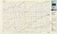
1985 Map of Oberlin
USGS Topo · Published 1985About this map
The convergence of South Fork Sappa Creek and Sappa Creek highlights the agricultural and transport geography of Northwest Kansas in the mid-1980s. Oberlin serves as the central hub for the region, connected to outlying farming communities like Herndon and Norcatur by a grid of rural roads and the Burlington Northern railroad lines. The landscape is defined by the braided drainage patterns of Beaver Creek and the North Fork Solomon River, with the Norton State Wildlife Area and Keith Sebelius Lake providing significant recreational and water management features on the eastern edge. Smaller, more isolated settlements such as New Almelo and Leoville reflect the enduring rural settlement patterns of the High Plains, while the presence of several sandpits and a quarry near Reager indicate local extraction industries vital to the area's infrastructure and development during this era.
Find a feature on this map
61 named features on this map. Tap any name to fly to it.
Don’t see what you’re looking for? This feature index may not catch every label — zoom into the map to look around manually.
Map Details
Editions of this 1985 Oberlin Map
2 editions found
Other maps of this area

1893 · Norton
USGS Topo · 1:125,000

1893 · Hill
USGS Topo · 1:125,000

1896 · Arapahoe
USGS Topo · 1:125,000

1898 · Arapahoe
USGS Topo · 1:125,000

1943 · Colby
USGS Topo · 1:62,500

1951 · Selden
USGS Topo · 1:62,500

1951 · Norton
USGS Topo · 1:62,500

1951 · Herndon
USGS Topo · 1:62,500

1951 · Achilles
USGS Topo · 1:62,500

1951 · Atwood
USGS Topo · 1:62,500