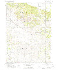
1968 Map of Obert
USGS Topo · Published 1977About this map
Obert serves as the primary hub of this Cedar County landscape, surveyed in the late 1960s as part of the Missouri River Basin development program. The topography is defined by the winding drainages of Ames Creek, Lime Creek, and East Bow Creek, which carve through the loess hills of northeast Nebraska. Evidence of early rural life is preserved through several localized schoolhouses, such as Brookey Bottom Sch and Sunny Lea Sch, alongside the Historical Monument positioned near the northern bluffs. The map captures the agricultural and extractive character of the era, noting small-scale Sandpit operations and several rural burying grounds including Obert Cem and Lime Creek Cem. This survey provides a precise record of the road network and property divisions within Prec 6 and Prec 7 before modern development altered the rural school and township structure.
Find a feature on this map
17 named features on this map. Tap any name to fly to it.
Don’t see what you’re looking for? This feature index may not catch every label — zoom into the map to look around manually.
Map Details
Editions of this 1968 Obert Map
2 editions found
Other maps of this area

1898 · Elk Point
USGS Topo · 1:125,000

1901 · Elk Point
USGS Topo · 1:125,000

1907 · Elk Point
USGS Topo · 1:125,000

1955 · Sioux City
USGS Topo · 1:250,000

1958 · Sioux City
USGS Topo · 1:250,000

1959 · Sioux City
USGS Topo · 1:250,000

1964 · Martinsburg SW
USGS Topo · 1:24,000

1964 · Maskell
USGS Topo · 1:24,000

1968 · Obert
USGS Topo · 1:24,000

1968 · St. Helena
USGS Topo · 1:24,000