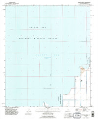
1992 Map of Obsidian Butte
USGS Topo · Published 1995About this map
Salton Sea dominates the landscape of this Imperial County quadrangle, where the water's surface sat at an elevation of 228 feet below sea level at the time of the 1992 revision. The map reveals the intricate water management system required for the surrounding basin, defined by a dense network of irrigation channels including Vail 6 Drain, Vail 7 Drain, and several Lateral branches. A prominent geological landmark, Obsidian Butte, rises along the southeastern shore, providing a rare point of topographical relief in the low-lying desert.
Find a feature on this map
15 named features on this map. Tap any name to fly to it.
Don’t see what you’re looking for? This feature index may not catch every label — zoom into the map to look around manually.
Map Details
Editions of this 1992 Obsidian Butte Map
This is the sole edition of this map. No revisions or reprints were ever made.
Other maps of this area

1940 · Kane Spring
USGS Topo · 1:62,500

1940 · Frink
USGS Topo · 1:62,500

1940 · Durmid
USGS Topo · 1:62,500

1944 · Durmid
USGS Topo · 1:62,500

1944 · Kane Spring
USGS Topo · 1:62,500

1944 · Calipatria
USGS Topo · 1:62,500

1944 · Frink
USGS Topo · 1:62,500

1954 · Salton Sea
USGS Topo · 1:250,000

1955 · Salton Sea
USGS Topo · 1:250,000
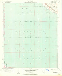
1956 · Durmid SE
USGS Topo · 1:24,000