Loading...
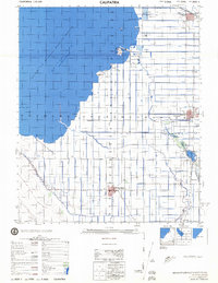
Loading map...1944 Map of Calipatria
USGS Topo · Published 1945About this map
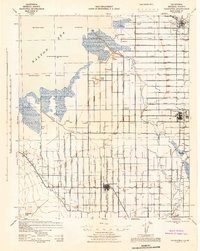
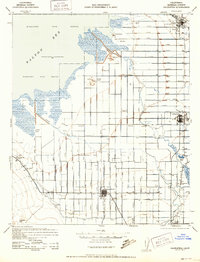
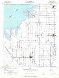
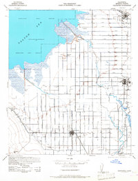
The Salton Sea dominates the northwest corner of this Imperial Valley landscape, its 1943 water level recorded at 241 feet below sea level. This wartime survey by the Corps of Engineers details an intricate irrigation network essential to the region's desert agriculture, including the Alamo Canal, Vail Canal, and numerous lateral branches designated by letter and location. Unusual geologic and industrial features dot the shoreline, such as the Mud Pots and Dry Ice Wells near Niland, alongside Mullet Island and Red Island.
Find a feature on this map
57 named features on this map. Tap any name to fly to it.
Don’t see what you’re looking for? This feature index may not catch every label — zoom into the map to look around manually.
Map Details
Date Portrayed1944
Date Published1945
PublisherU.S. Geological Survey
Map TypeTopographic
Scale1:62,500
Physical Dimensions17.3 x 21.7 inches
Editions of this 1944 Calipatria Map
4 editions found
Historical Maps of Brawley Through Time
Featured Locations
Source Details
SourceU.S. Geological Survey
CopyrightPublic Domain