
1940 Map of Iris Pass
USGS Topo · Published 1956About this map
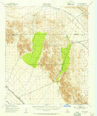
The Chocolate Mountain Aerial Gunnery Range dominates this landscape, establishing a significant military presence across the desert terrain of the Chocolate Mountains. Published for civil use during the mid-1950s but based on 1940 aerial photography, the map illustrates a pivotal era for water management in the California desert. The Coachella Canal and East Highline Canal represent major infrastructure projects intended to transform arid stretches into arable land. Historic routes like the Ehrenberg Road and Approximate Augustine Road cut through the passes of the Chuckwalla Mts, tracing paths used by early travelers. Natural water sources like Salvation Spring appear near Salvation Pass, serving as critical landmarks in an otherwise unforgiving environment marked by peaks such as Lion Head Mtn and the drainage of Arroyo Seco.
Find a feature on this map
14 named features on this map. Tap any name to fly to it.
Don’t see what you’re looking for? This feature index may not catch every label — zoom into the map to look around manually.
Map Details
Editions of this 1940 Iris Pass Map
2 editions found
Other maps of this area

1940 · Iris
USGS Topo · 1:62,500

1940 · Frink
USGS Topo · 1:62,500

1940 · Canyon Spring
USGS Topo · 1:62,500

1943 · Canyon Spring
USGS Topo · 1:62,500

1944 · Chuckwalla Mountains
USGS Topo · 1:62,500

1944 · Calipatria
USGS Topo · 1:62,500

1944 · Frink
USGS Topo · 1:62,500

1945 · Iris Pass
USGS Topo · 1:62,500

1945 · Iris
USGS Topo · 1:62,500

1952 · Sidewinder Well
USGS Topo · 1:62,500