
1952 Map of Sidewinder Well
USGS Topo · Published 1953About this map
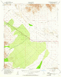
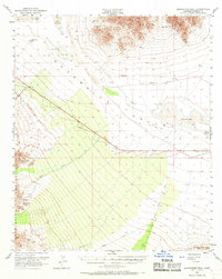
Chuckwalla Valley dominates this 1952 topographic study, revealing a landscape defined by water management and mineral extraction in the Colorado Desert. The topography is framed by the Palen Mountains to the north and the Chuckwalla Mountains to the south, where the Aztec Mines and various Prospect sites suggest the era's ongoing mining interest. The arid nature of the region is punctuated by ephemeral features such as Palen Dry Lake and Ford Dry Lake, along with a massive Diversion Dike and a prominent Pipe Line cutting through the valley floor. Transportation and navigation markers include the remote Sidewinder Well and an Airway Beacon, which served as vital checkpoints in this desert corridor. Primitive routes like Corn Springs Road and Dupont Road trace the paths of mid-century travelers and miners through the Sand Dunes.
Find a feature on this map
20 named features on this map. Tap any name to fly to it.
Don’t see what you’re looking for? This feature index may not catch every label — zoom into the map to look around manually.
Map Details
Editions of this 1952 Sidewinder Well Map
3 editions found
Other maps of this area

1940 · Iris Pass
USGS Topo · 1:62,500

1942 · Blythe
USGS Topo · 1:250,000

1943 · Coxcomb Mountains
USGS Topo · 1:62,500

1944 · Chuckwalla Mountains
USGS Topo · 1:62,500

1944 · Coxcomb Mountains
USGS Topo · 1:62,500

1945 · Midland
USGS Topo · 1:62,500

1945 · Iris Pass
USGS Topo · 1:62,500

1952 · Midland
USGS Topo · 1:62,500

1952 · Mc Coy Spring
USGS Topo · 1:62,500

1952 · Palen Mountains
USGS Topo · 1:62,500