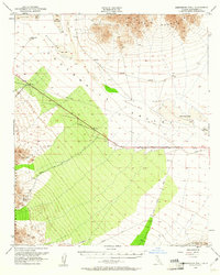
1952 Map of Sidewinder Well
USGS Topo · Published 1961About this map
Chuckwalla Valley dominates this arid landscape, flanked by the Palen Mountains to the north and the Chuckwalla Mountains to the south. In the early 1950s, this desert corridor was a nexus of infrastructure and resource extraction, as evidenced by the Pipe Line and Diversion Dike cutting across the valley floor. Near the southern peaks, the Aztec Mines and its associated Aztec Mines Reservoir represent the area's mineral interests, while the Sidewinder Well provides a vital water point in the western reaches. The transition from active mining to regional transport is visible through a network of desert tracks, including Corn Springs Road and Niland Blythe Road, and the presence of an Airway Beacon for early aviation. Large ephemeral features like Palen Dry Lake and Ford Dry Lake define the hydrology of this rugged Riverside County basin.
Find a feature on this map
20 named features on this map. Tap any name to fly to it.
Don’t see what you’re looking for? This feature index may not catch every label — zoom into the map to look around manually.
Map Details
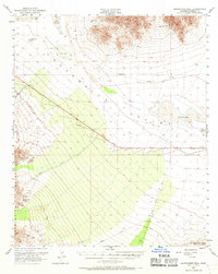
Editions of this 1952 Sidewinder Well Map
3 editions found
Other maps of this area

1940 · Iris Pass
USGS Topo · 1:62,500

1942 · Blythe
USGS Topo · 1:250,000

1943 · Coxcomb Mountains
USGS Topo · 1:62,500

1944 · Chuckwalla Mountains
USGS Topo · 1:62,500

1944 · Coxcomb Mountains
USGS Topo · 1:62,500

1945 · Midland
USGS Topo · 1:62,500

1945 · Iris Pass
USGS Topo · 1:62,500

1952 · Midland
USGS Topo · 1:62,500

1952 · Mc Coy Spring
USGS Topo · 1:62,500

1952 · Sidewinder Well
USGS Topo · 1:62,500