Loading...
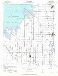
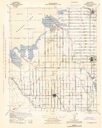
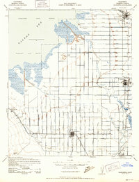
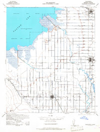
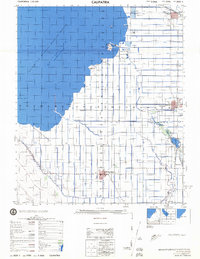
Loading map...1944 Map of Calipatria
USGS Topo · Published 1963About this map
The Salton Sea dominates the northwest corner of this mid-century Imperial County landscape, its shoreline receding to reveal unique geothermal and geological features like the Mud Pots and Obsidian Butte. In the early 1940s, the surrounding basin was a hive of agricultural and industrial expansion, sustained by an intricate grid of irrigation channels including the Vail Canal and West Side Main Canal.
Find a feature on this map
59 named features on this map. Tap any name to fly to it.
Don’t see what you’re looking for? This feature index may not catch every label — zoom into the map to look around manually.
Map Details
Date Portrayed1944
Date Published1963
PublisherU.S. Geological Survey
Map TypeTopographic
Scale1:62,500
Physical Dimensions16.6 x 21.8 inches
Editions of this 1944 Calipatria Map
4 editions found
Historical Maps of Brawley Through Time
Featured Locations
Source Details
SourceU.S. Geological Survey
CopyrightPublic Domain