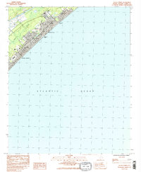
1984 Map of Ocean Forest
USGS Topo · Published 1984About this map
Myrtle Beach and the neighboring community of Ocean Forest are captured here during a period of significant coastal development in the mid-1980s. The map illustrates a landscape where established neighborhoods and community centers meet the natural drainage systems of the Grand Strand, such as Canepatch Swash and Deephead Swash. The inland boundary is defined by the Intracoastal Waterway, while the shoreline features a dense network of residential streets from 45th Ave N up to 82d Ave N. Local social and educational foundations are visible through several community institutions, including Coastal Academy, Memorial Stadium, and a concentration of local congregations like Northside Ch, Phillips Ch, and St Andrews Ch. The presence of the Pine Lakes Country Club and numerous coastal swashes reflects the traditional land use patterns of this South Carolina resort corridor before the most modern intensifications.
Find a feature on this map
98 named features on this map. Tap any name to fly to it.
Don’t see what you’re looking for? This feature index may not catch every label — zoom into the map to look around manually.
Map Details
Editions of this 1984 Ocean Forest Map
2 editions found
Other maps of this area

1937 · Myrtle Beach
USGS Topo · 1:48,000

1937 · Nixonville
USGS Topo · 1:48,000

1940 · Myrtle Beach
USGS Topo · 1:62,500

1942 · Nixonville
USGS Topo · 1:62,500

1943 · Wampee
USGS Topo · 1:24,000

1949 · Georgetown
USGS Topo · 1:250,000

1967 · Georgetown
USGS Topo · 1:250,000

1974 · Georgetown
USGS Topo · 1:250,000
1984 · Nixonville
USGS Topo · 1:24,000
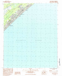
1984 · Ocean Forest
USGS Topo · 1:24,000