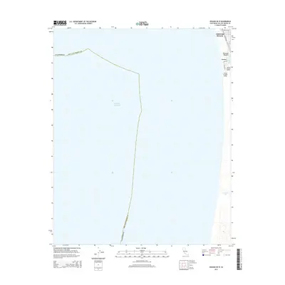
2015 Map of Oceano OE W
USGS Topo · Published 2015About this map
Grover Beach and Oceano occupy the narrow coastal strip of San Luis Obispo County on this 2015 survey, where the terrestrial landscape meets the vast Pacific Ocean. This coastal margin is defined by its transit and recreation infrastructure, including the Oceano County Airport and a residential grid featuring Pacific Blvd and Pier Ave. The map captures the transition from the developed streets of Grover Beach to the more open geography of Oceano Beach and the Arroyo Grande Valley. Further south, the terrain becomes increasingly maritime and natural, characterized by the waters of Oso Flaco Lake and the meandering path of Meadow Creek. The proximity of the shoreline to these inland water bodies highlights the delicate coastal ecology of the Central Coast region during the early 21st century.
Find a feature on this map
14 named features on this map. Tap any name to fly to it.
Don’t see what you’re looking for? This feature index may not catch every label — zoom into the map to look around manually.
Map Details
Editions of this 2015 Oceano OE W Map
This is the sole edition of this map. No revisions or reprints were ever made.
Other maps of this area
1897 · Port Harford
USGS Topo · 1:62,500
1897 · Arroyo Grande
USGS Topo · 1:62,500
1900 · San Luis
USGS Topo · 1:125,000
1905 · Guadalupe
USGS Topo · 1:125,000
1941 · Port San Luis
USGS Topo · 1:62,500
1942 · Guadalupe
USGS Topo · 1:125,000
1942 · Arroyo Grande
USGS Topo · 1:62,500
1942 · Point Sal
USGS Topo · 1:62,500
1945 · Port San Luis
USGS Topo · 1:62,500
1947 · Guadalupe
USGS Topo · 1:24,000