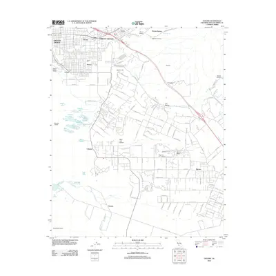
2012 Map of Oceano
USGS Topo · Published 2012About this map
The coastal landscapes of southern San Luis Obispo County are defined by a complex network of coastal lakes and dune structures at the start of the 2010s. Near the shoreline, Oceano and Grover Beach transition into the shifting Callender Dunes and Guadalupe Dunes, which hem in a series of small water bodies including Oso Flaco Lake, Jack Lake, and Bolsa Chica Lake. This environment supports a mix of residential expansion and agricultural utility, with the Oceano County Airport serving as a local transportation hub. Further inland, the map captures the community of Arroyo Grande and the smaller settlements of Halcyon and Los Berros. The terrain rises toward Picacho and Nipomo Hill, where canyons like Newsom Canyon and Black Lake Canyon carve into the mesa. Cultural landmarks such as the Maison Deutz Winery and the Black Lake Golf Course reflect the region's development as a destination for both viticulture and recreation.
Find a feature on this map
134 named features on this map. Tap any name to fly to it.
Don’t see what you’re looking for? This feature index may not catch every label — zoom into the map to look around manually.
Map Details
Editions of this 2012 Oceano Map
This is the sole edition of this map. No revisions or reprints were ever made.
Other maps of this area

1897 · Arroyo Grande
USGS Topo · 1:62,500

1900 · San Luis
USGS Topo · 1:125,000

1905 · Guadalupe
USGS Topo · 1:125,000

1905 · Lompoc
USGS Topo · 1:125,000

1922 · Nipomo
USGS Topo · 1:62,500

1942 · Guadalupe
USGS Topo · 1:125,000

1942 · Lompoc
USGS Topo · 1:125,000

1942 · Arroyo Grande
USGS Topo · 1:62,500

1942 · Santa Maria
USGS Topo · 1:62,500

1942 · Point Sal
USGS Topo · 1:62,500