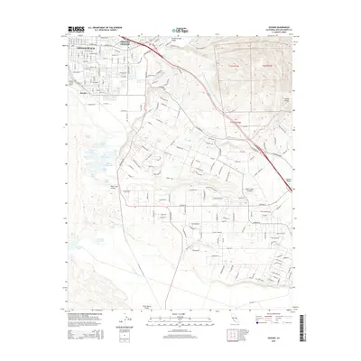
2015 Map of Oceano
USGS Topo · Published 2015About this map
Grover Beach and the neighboring city of Arroyo Grande anchor this coastal landscape along the Central Coast. The topography is defined by a series of distinct valleys, including the Arroyo Grande Valley and the Nipomo Valley, where the drainage of Arroyo Grande Cr and Los Berros Cr shapes the lowland terrain. Further south, a complex of small water bodies including Bolsa Chica Lake, White Lake, and Jack Lake transition into the dunes and wetlands surrounding Oso Flaco Lake. A significant infrastructure feature, the Governor Edmund G Brown Coastal Br California Aqueduct, cuts across the eastern hills. This 2015 survey details the dense suburban street grids of the northern coastal towns in contrast with the larger agricultural parcels and open spaces of the Santa Maria Valley to the south, providing a modern record of land use and water management in San Luis Obispo County.
Find a feature on this map
155 named features on this map. Tap any name to fly to it.
Don’t see what you’re looking for? This feature index may not catch every label — zoom into the map to look around manually.
Map Details
Editions of this 2015 Oceano Map
This is the sole edition of this map. No revisions or reprints were ever made.
Other maps of this area

1897 · Arroyo Grande
USGS Topo · 1:62,500

1900 · San Luis
USGS Topo · 1:125,000

1905 · Guadalupe
USGS Topo · 1:125,000

1905 · Lompoc
USGS Topo · 1:125,000

1922 · Nipomo
USGS Topo · 1:62,500

1942 · Guadalupe
USGS Topo · 1:125,000

1942 · Lompoc
USGS Topo · 1:125,000

1942 · Arroyo Grande
USGS Topo · 1:62,500

1942 · Santa Maria
USGS Topo · 1:62,500

1942 · Point Sal
USGS Topo · 1:62,500