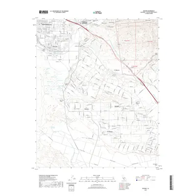
2018 Map of Oceano
USGS Topo · Published 2018About this map
The coastal dunes and agricultural valleys of San Luis Obispo County are captured in this 2018 survey, revealing the complex landscape of the Central Coast. Grover Beach and Oceano dominate the northwestern shoreline, while the historic Uprr corridor threads through the region, supporting the area's movement and industry. The map highlights a unique chain of freshwater bodies east of the coast, including Willow Lake, Hospital Lake, and Bolsa Chica Lake, which punctuate the lowlands between the urban centers and the rising terrain of Newsom Ridge.
Find a feature on this map
231 named features on this map. Tap any name to fly to it.
Don’t see what you’re looking for? This feature index may not catch every label — zoom into the map to look around manually.
Map Details
Editions of this 2018 Oceano Map
This is the sole edition of this map. No revisions or reprints were ever made.
Other maps of this area

1897 · Arroyo Grande
USGS Topo · 1:62,500

1900 · San Luis
USGS Topo · 1:125,000

1905 · Guadalupe
USGS Topo · 1:125,000

1905 · Lompoc
USGS Topo · 1:125,000

1922 · Nipomo
USGS Topo · 1:62,500

1942 · Guadalupe
USGS Topo · 1:125,000

1942 · Lompoc
USGS Topo · 1:125,000

1942 · Arroyo Grande
USGS Topo · 1:62,500

1942 · Santa Maria
USGS Topo · 1:62,500

1942 · Point Sal
USGS Topo · 1:62,500