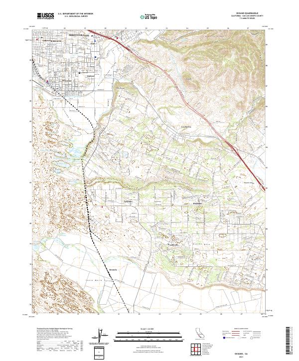
2021 Map of Oceano
USGS Topo · Published 2021About this map
Arroyo Grande Creek winds through the central valley of this coastal landscape, serving as a geographic anchor for the communities of Oceano and Grover Beach. The 2021 survey documents a mix of dense residential development and coastal wetlands, particularly evident in the Cienega Valley where numerous water bodies like Big Twin Lake and Bolsa Chica Lake persist. The presence of the Pacific Coast Ry alignment and historic sites like the Arroyo Grande Cem and Halcyon Cem provide essential data points for local historians and genealogists tracking the evolution of the Arroyo Grande Valley. Further south, the terrain shifts into the Nipomo Mesa, characterized by the planned communities of Blacklake and Woodlands, alongside the preserve of Oso Flaco Lake.
Find a feature on this map
62 named features on this map. Tap any name to fly to it.
Don’t see what you’re looking for? This feature index may not catch every label — zoom into the map to look around manually.
Map Details
Editions of this 2021 Oceano Map
This is the sole edition of this map. No revisions or reprints were ever made.
Other maps of this area

1897 · Arroyo Grande
USGS Topo · 1:62,500

1900 · San Luis
USGS Topo · 1:125,000

1905 · Guadalupe
USGS Topo · 1:125,000

1905 · Lompoc
USGS Topo · 1:125,000

1922 · Nipomo
USGS Topo · 1:62,500

1942 · Guadalupe
USGS Topo · 1:125,000

1942 · Lompoc
USGS Topo · 1:125,000

1942 · Arroyo Grande
USGS Topo · 1:62,500

1942 · Santa Maria
USGS Topo · 1:62,500

1942 · Point Sal
USGS Topo · 1:62,500