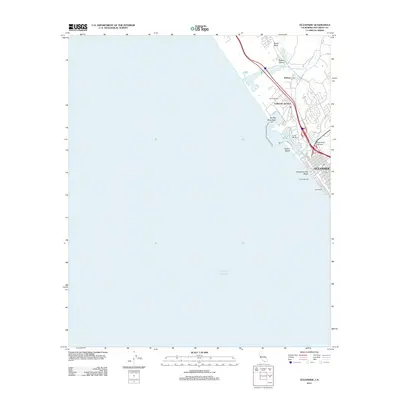
2012 Map of Oceanside
USGS Topo · Published 2012About this map
Oceanside is depicted here during a period of significant coastal development, where the residential grids of the city meet the massive military footprint of Camp Pendleton. This 2012 survey illustrates the critical intersection of transit and geography, where the Santa Margarita River and San Luis Rey River reach the Pacific Ocean. The map documents the intricate layout of the shoreline, from the iconic Oceanside Pier and the adjacent Oceanside City Beach to the specialized maritime infrastructure of the Del Mar Boat Basin and North Harbor. Inland, the topography is defined by Newton Canyon and Lawrence Canyon, while the northern portion of the sheet is dominated by military installations like Camp Del Mar and the training grounds around Stuart Mesa. Local transport hubs, including Fallbrook Junction, highlight the area's role as a coastal crossroads between San Diego and points north.
Find a feature on this map
30 named features on this map. Tap any name to fly to it.
Don’t see what you’re looking for? This feature index may not catch every label — zoom into the map to look around manually.
Map Details
Editions of this 2012 Oceanside Map
This is the sole edition of this map. No revisions or reprints were ever made.
Other maps of this area

1893 · Oceanside
USGS Topo · 1:62,500

1898 · Oceanside
USGS Topo · 1:62,500

1901 · Oceanside
USGS Topo · 1:62,500

1901 · San Luis Rey
USGS Topo · 1:125,000

1902 · Capistrano
USGS Topo · 1:125,000

1904 · Southern California Sheet No. 2
USGS Topo · 1:250,000

1906 · Capistrano
USGS Topo · 1:125,000

1941 · Margarita Peak
USGS Topo · 1:62,500

1942 · Margarita Peak
USGS Topo · 1:62,500

1942 · San Juan Capistrano
USGS Topo · 1:62,500