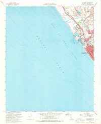
1968 Map of Oceanside
USGS Topo · Published 1970About this map
The coastal military presence at Camp Pendleton Marine Corps Base dominates the northern half of this coastal landscape, where Stuart Mesa overlooks the Gulf of Santa Catalina. The interaction between the base and the growing city of Oceanside is visible through the infrastructure of the Atchison Topeka and Santa Fe railroad and the San Diego Freeway, which cut through the military reservation and the historic Santa Margarita area.
Find a feature on this map
26 named features on this map. Tap any name to fly to it.
Don’t see what you’re looking for? This feature index may not catch every label — zoom into the map to look around manually.
Map Details
Editions of this 1968 Oceanside Map
2 editions found
Other maps of this area

1893 · Oceanside
USGS Topo · 1:62,500

1898 · Oceanside
USGS Topo · 1:62,500

1901 · Oceanside
USGS Topo · 1:62,500

1901 · San Luis Rey
USGS Topo · 1:125,000

1902 · Capistrano
USGS Topo · 1:125,000

1904 · Southern California Sheet No. 2
USGS Topo · 1:250,000

1906 · Capistrano
USGS Topo · 1:125,000

1941 · Margarita Peak
USGS Topo · 1:62,500

1942 · Margarita Peak
USGS Topo · 1:62,500

1942 · San Juan Capistrano
USGS Topo · 1:62,500