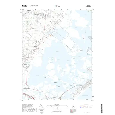
2019 Map of Oceanville
USGS Topo · Published 2019About this map
Smithville and Leeds Point anchor the northern landscape of this Atlantic County coastal region, where the mainland meets an intricate network of salt marshes and tidal channels. The settlement pattern follows historical corridors like Shore Road and Galloway Road, connecting established communities such as Oceanville and Conovertown. This map captures the complex hydrography of the back bays, showing the Intracoastal Waterway as it threads through Reeds Bay and Grassy Bay. Further south, the urban development of Pleasantville and the northern reaches of Atlantic City contrast with the maritime character of the barrier island at Brigantine. Distinctive landforms such as Mankiller Island and Sunflower Island remain prominent within the tidal flats, illustrating the precarious and shifting nature of the Jersey Shore's interior waterways.
Find a feature on this map
158 named features on this map. Tap any name to fly to it.
Don’t see what you’re looking for? This feature index may not catch every label — zoom into the map to look around manually.
Map Details
Editions of this 2019 Oceanville Map
This is the sole edition of this map. No revisions or reprints were ever made.
Other maps of this area

1887 · Atlantic City
USGS Topo · 1:62,500

1888 · Little Egg Harbor
USGS Topo · 1:62,500

1890 · Great Egg Harbor
USGS Topo · 1:62,500

1890 · Mullica
USGS Topo · 1:62,500

1893 · Great Egg Harbor
USGS Topo · 1:62,500

1893 · Little Egg Harbor
USGS Topo · 1:62,500

1894 · Atlantic City
USGS Topo · 1:62,500

1894 · Mullica
USGS Topo · 1:62,500

1898 · Mullica
USGS Topo · 1:62,500

1900 · Rancocas
USGS Topo · 1:125,000
Featured Places
- Egg Harbor Township, NJ
- Atlantic City, NJ
- Galloway Township, NJ
- Little Egg Harbor Township, NJ
- Pleasantville, NJ