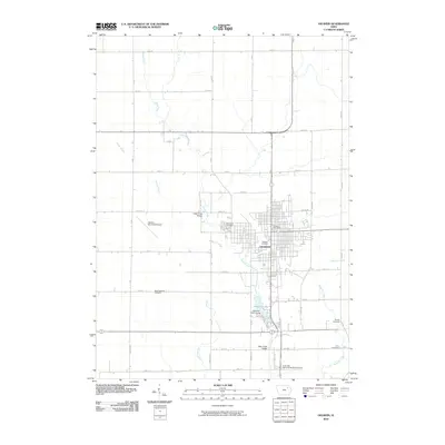
2010 Map of Oelwein
USGS Topo · Published 2010About this map
Oelwein serves as the central hub of this Fayette County landscape, where a dense grid of streets meets the meandering course of Otter Creek. The town's layout is anchored by civic markers such as the Oelwein Post Office and the expansive Woodlawn Cemetery to the west, while the southern edge of the community is defined by Oelwein Lake and the adjacent Lakeview Golf Course. Beyond the city limits, the terrain opens into a systematic township grid of agricultural roads, including Amish Blvd and Neon Rd. This rural expanse is dotted with small family and township burial grounds, such as Oran Township Cemetery and Kint Cemetery, providing essential data points for those tracing local lineages. The presence of the Oelwein Municipal Airport and the Otter Creek Bridge highlights the area's role as a regional transport and infrastructure node during the early twenty-first century.
Find a feature on this map
38 named features on this map. Tap any name to fly to it.
Don’t see what you’re looking for? This feature index may not catch every label — zoom into the map to look around manually.
Map Details
Editions of this 2010 Oelwein Map
This is the sole edition of this map. No revisions or reprints were ever made.
Other maps of this area

1901 · Oelwein
USGS Topo · 1:125,000

1954 · Waterloo
USGS Topo · 1:250,000

1955 · Waterloo
USGS Topo · 1:250,000

1959 · Dubuque
USGS Topo · 1:250,000

1961 · Dubuque
USGS Topo · 1:250,000

1962 · Dubuque
USGS Topo · 1:250,000

1971 · Sumner
USGS Topo · 1:24,000

1971 · Fairbank
USGS Topo · 1:24,000

1971 · Littleton
USGS Topo · 1:24,000

1976 · Dubuque
USGS Topo · 1:250,000