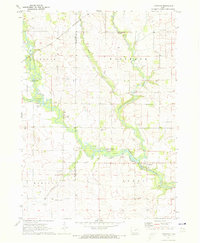
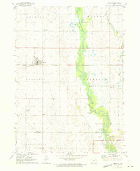
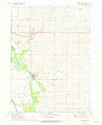
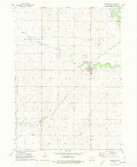
1971 Map of Littleton
USGS Topo · Published 1973About this map
The Wapsipinicon River and Little Wapsipinicon River converge in this rural corner of Northeast Iowa, defining the boundary between Lester and Fairbank townships. The settlement of Littleton serves as the focal point, situated at a bend in the river just north of the Perry township line. This 1971 field-checked survey reveals a landscape deeply connected to its agricultural and community roots, documented through numerous country schools like Center Sch and Triumph Sch.
Find a feature on this map
32 named features on this map. Tap any name to fly to it.
Don’t see what you’re looking for? This feature index may not catch every label — zoom into the map to look around manually.
Map Details
Editions of this 1971 Littleton Map
This is the sole edition of this map. No revisions or reprints were ever made.
Other maps of this area

1901 · Oelwein
USGS Topo · 1:125,000

1903 · Winthrop
USGS Topo · 1:125,000

1954 · Waterloo
USGS Topo · 1:250,000

1955 · Waterloo
USGS Topo · 1:250,000

1959 · Dubuque
USGS Topo · 1:250,000

1961 · Dubuque
USGS Topo · 1:250,000

1962 · Dubuque
USGS Topo · 1:250,000
1971 · Readlyn
USGS Topo · 1:24,000
1971 · Gilbertville
USGS Topo · 1:24,000
1971 · Dunkerton
USGS Topo · 1:24,000