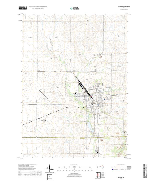
2022 Map of Oelwein
USGS Topo · Published 2022About this map
Oelwein dominates this corner of Northeast Iowa, serving as a significant crossroads at the junction of t91n r9w and surrounding townships. The landscape is defined by the gentle drainage patterns of Otter Creek and Hunter Creek, which weave through a grid of section lines and county roads like Co Hwy W14 and Co Hwy W13. The area is notably dense with local historical markers, including several rural burial grounds such as Oran Township Cem and Otsego Cem. To the west of the city center, the Oelwein Municipal Airport provides a modern utility to this agricultural hub. The southern edge of the survey captures the border between Fayette and Buchanan counties, marked by Co Line Rd E, near the sprawling grounds of Floral Hills Memorial Gardens Cem.
Find a feature on this map
104 named features on this map. Tap any name to fly to it.
Don’t see what you’re looking for? This feature index may not catch every label — zoom into the map to look around manually.
Map Details
Editions of this 2022 Oelwein Map
This is the sole edition of this map. No revisions or reprints were ever made.
Other maps of this area

1901 · Oelwein
USGS Topo · 1:125,000

1954 · Waterloo
USGS Topo · 1:250,000

1955 · Waterloo
USGS Topo · 1:250,000

1959 · Dubuque
USGS Topo · 1:250,000

1961 · Dubuque
USGS Topo · 1:250,000

1962 · Dubuque
USGS Topo · 1:250,000

1971 · Sumner
USGS Topo · 1:24,000

1971 · Fairbank
USGS Topo · 1:24,000

1971 · Littleton
USGS Topo · 1:24,000

1976 · Dubuque
USGS Topo · 1:250,000