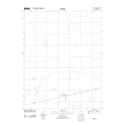
2012 Map of Offerle
USGS Topo · Published 2012About this map
The small Kansas town of Offerle is centered along the transport corridor of US Highway 50 and the railroad line, shown here as it appeared in the early 21st century. The town's grid is small and compact, featuring a Post Office and streets like S Main St and W Front St. Outside the town center, the landscape is defined by the winding course of Little Coon Creek, which meanders across the southern and central sections of the survey. To the northwest, White Woman Creek cuts through the open plains. Local history is anchored by two key sites, Saint Joseph Cemetery to the west and Evergreen Cemetery to the north, which serve as long-standing landmarks for the surrounding rural community. The area's agricultural character is reflected in the extensive network of secondary roads, such as Antelope Rd and Pole Line Rd, that divide the prairie into a regular grid.
Find a feature on this map
20 named features on this map. Tap any name to fly to it.
Don’t see what you’re looking for? This feature index may not catch every label — zoom into the map to look around manually.
Map Details
Editions of this 2012 Offerle Map
This is the sole edition of this map. No revisions or reprints were ever made.
Other maps of this area

1889 · Larned
USGS Topo · 1:125,000

1889 · Kinsley
USGS Topo · 1:125,000

1891 · Larned
USGS Topo · 1:125,000

1892 · Ness
USGS Topo · 1:125,000

1892 · Kinsley
USGS Topo · 1:125,000

1892 · Spearville
USGS Topo · 1:125,000

1894 · Spearville
USGS Topo · 1:125,000

1894 · Kinsley
USGS Topo · 1:125,000

1894 · Ness
USGS Topo · 1:125,000

1955 · Great Bend
USGS Topo · 1:250,000