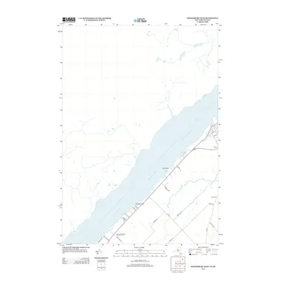
2013 Map of Ogdensburg West
USGS Topo · Published 2013About this map
The Saint Lawrence River dominates this coastal landscape on the New York and Ontario border, defining the geographic character of the region southwest of Ogdensburg. In 2013, the shoreline is punctuated by prominent features such as Nevins Point and Stillwells Point, while the adjacent inland areas maintain a mix of recreational and residential development. The Saint Lawrence State Park Golf Course occupies a significant portion of the riverfront, flanked by local names like Fishel Farms and Riverwood Acres. The road network provides evidence of the area's agricultural and social history, including routes such as Stone Church Rd, Fell Farm Rd, and the curiously named Lost Village Rd. This survey documents a quiet riverfront economy where residential clusters like those on Ogden St and Gates St meet the expansive international waterway.
Find a feature on this map
26 named features on this map. Tap any name to fly to it.
Don’t see what you’re looking for? This feature index may not catch every label — zoom into the map to look around manually.
Map Details
Editions of this 2013 Ogdensburg West Map
This is the sole edition of this map. No revisions or reprints were ever made.
Other maps of this area

1904 · Lisbon
USGS Topo · 1:48,000

1904 · Ogdensburg
USGS Topo · 1:62,500

1905 · Ogdensburg
USGS Topo · 1:62,500

1906 · Brier Hill
USGS Topo · 1:62,500

1906 · Red Mills
USGS Topo · 1:62,500

1942 · Morristown
USGS Topo · 1:24,000

1943 · Ogdensburg East
USGS Topo · 1:31,680

1943 · Morristown
USGS Topo · 1:31,680
1943 · Red Mills
USGS Topo · 1:31,680

1943 · Edwardsville
USGS Topo · 1:31,680