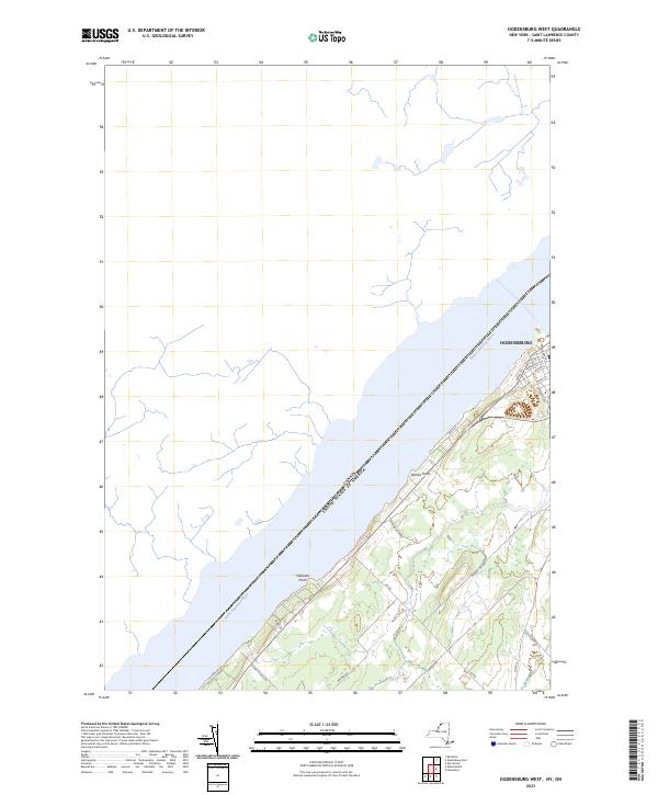
2023 Map of Ogdensburg West
USGS Topo · Published 2023About this map
The Saint Lawrence River serves as the dominant geographical feature and international boundary in this modern topographic study, separating New York from Canada. The western edge of Ogdensburg is captured in detail, showing the street grid including Main St, Albany Ave, and King St. This portion of the riverfront is characterized by significant points of land such as Stillwells Point and Nevins Point, which break the shoreline and influence the local hydrography.
Find a feature on this map
25 named features on this map. Tap any name to fly to it.
Don’t see what you’re looking for? This feature index may not catch every label — zoom into the map to look around manually.
Map Details
Editions of this 2023 Ogdensburg West Map
This is the sole edition of this map. No revisions or reprints were ever made.
Other maps of this area

1904 · Lisbon
USGS Topo · 1:48,000

1904 · Ogdensburg
USGS Topo · 1:62,500

1905 · Ogdensburg
USGS Topo · 1:62,500

1906 · Brier Hill
USGS Topo · 1:62,500

1906 · Red Mills
USGS Topo · 1:62,500

1942 · Morristown
USGS Topo · 1:24,000

1943 · Ogdensburg East
USGS Topo · 1:31,680

1943 · Morristown
USGS Topo · 1:31,680
1943 · Red Mills
USGS Topo · 1:31,680

1943 · Edwardsville
USGS Topo · 1:31,680