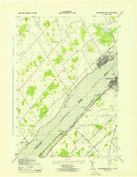
1943 Map of Ogdensburg West
USGS Topo · Published 1943About this map
The St. Lawrence River serves as the international boundary between New York and Ontario in this 1943 survey, separating the city of Ogdensburg from Prescott. The map details the cross-border connectivity of the era, noting the Ferry route and the convergence of the Canadian National and Canadian Pacific railroads on the northern shore. On the American side, the landscape of Oswegatchie is defined by a network of rural roads such as Lost Village Rd and Monkey Hill Road, interspersed with local landmarks like the Pythian Home and several numbered schoolhouses.
Find a feature on this map
31 named features on this map. Tap any name to fly to it.
Don’t see what you’re looking for? This feature index may not catch every label — zoom into the map to look around manually.
Map Details
Editions of this 1943 Ogdensburg West Map
This is the sole edition of this map. No revisions or reprints were ever made.
Other maps of this area

1904 · Lisbon
USGS Topo · 1:48,000

1904 · Ogdensburg
USGS Topo · 1:62,500

1905 · Ogdensburg
USGS Topo · 1:62,500

1906 · Brier Hill
USGS Topo · 1:62,500

1906 · Red Mills
USGS Topo · 1:62,500

1942 · Morristown
USGS Topo · 1:24,000

1943 · Ogdensburg East
USGS Topo · 1:31,680

1943 · Morristown
USGS Topo · 1:31,680
1943 · Red Mills
USGS Topo · 1:31,680

1943 · Edwardsville
USGS Topo · 1:31,680