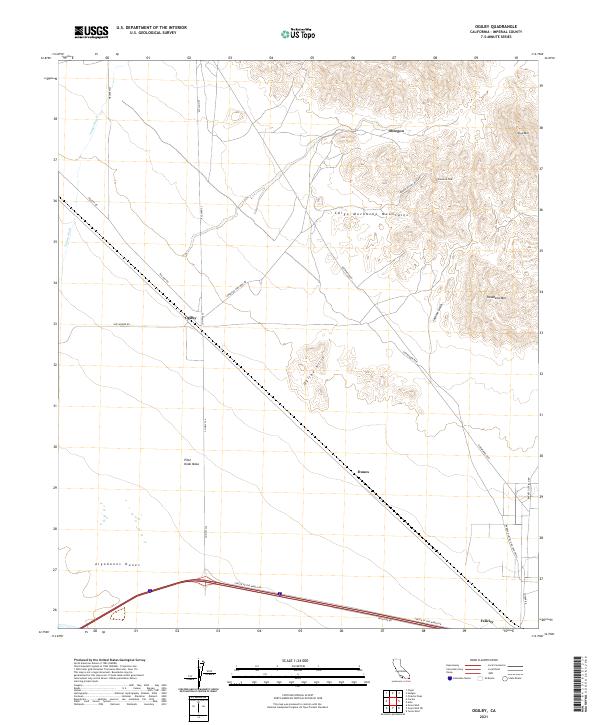
2021 Map of Ogilby
USGS Topo · Published 2021About this map
The Cargo Muchacho Mountains rise abruptly from the desert floor in this Imperial County landscape, anchoring a region defined by mining history and shifting sands. Just east of the massive Algodones Dunes, the map documents the small settlements of Ogilby and Felicity, the latter of which is famously accessed via Center of the World Dr. The road network provides evidence of the area's industrial past and present, with routes like American Girl Mine Rd leading into the heights near Pasadena Peak and Stud Mtn. The southern portion of the quadrangle is dominated by the broad expanse of Pilot Knob Mesa, while the northern reaches are carved by the ephemeral Tumco Wash, illustrating the extreme arid geography of the California desert as it appeared in the early 21st century.
Find a feature on this map
28 named features on this map. Tap any name to fly to it.
Don’t see what you’re looking for? This feature index may not catch every label — zoom into the map to look around manually.
Map Details
Editions of this 2021 Ogilby Map
This is the sole edition of this map. No revisions or reprints were ever made.
Other maps of this area

1903 · Yuma
USGS Topo · 1:125,000

1905 · Yuma
USGS Topo · 1:125,000

1940 · Yuma
USGS Topo · 1:62,500

1942 · Yuma
USGS Topo · 1:250,000

1945 · Picacho Peak
USGS Topo · 1:62,500

1945 · Yuma
USGS Topo · 1:62,500

1951 · Picacho Peak
USGS Topo · 1:62,500

1952 · Araz
USGS Topo · 1:24,000

1952 · Yuma West
USGS Topo · 1:24,000

1953 · Grays Well
USGS Topo · 1:24,000