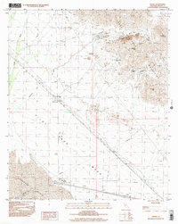
1997 Map of Ogilby
USGS Topo · Published 2002About this map
Mining operations dominate the Cargo Muchocho Mountains in this landscape of the late twentieth century. Numerous hard-rock extraction sites are documented, including the American Girl Mine, Padre Madre Mine, and Cargo Mine. The presence of Obregon and the Ogilby (Site) suggests the transition from active settlement to historical footprint. The landscape is sharply divided between the high peaks of Pasadena Peak and Stud Mountain and the shifting terrain of the Algodones Dunes to the southwest. Transport and utility infrastructure is represented by a persistent Trans Line and a system of dikes, while local history is anchored by a lone Cem near the Ogilby townsite. The intricate drainage network of American Girl Wash and Tumco Wash illustrates how water shaped the access routes into these mineral-rich canyons.
Find a feature on this map
28 named features on this map. Tap any name to fly to it.
Don’t see what you’re looking for? This feature index may not catch every label — zoom into the map to look around manually.
Map Details
Editions of this 1997 Ogilby Map
This is the sole edition of this map. No revisions or reprints were ever made.
Other maps of this area

1903 · Yuma
USGS Topo · 1:125,000

1905 · Yuma
USGS Topo · 1:125,000

1940 · Yuma
USGS Topo · 1:62,500

1942 · Yuma
USGS Topo · 1:250,000

1945 · Picacho Peak
USGS Topo · 1:62,500

1945 · Yuma
USGS Topo · 1:62,500

1951 · Picacho Peak
USGS Topo · 1:62,500

1952 · Araz
USGS Topo · 1:24,000

1952 · Yuma West
USGS Topo · 1:24,000

1953 · Grays Well
USGS Topo · 1:24,000