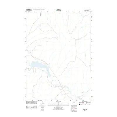
2012 Map of Oglala
USGS Topo · Published 2012About this map
Oglala Lake serves as a central landmark in this Oglala Lakota County landscape, positioned within a drainage system defined by the winding course of White Clay Cr. The terrain reflects a quiet, rural character typical of southwestern South Dakota in the early 21st century, where development is primarily focused along the corridor of BIA Rd. For those researching local history or genealogy, the presence of Saint James Cem in the southeastern quadrant provides a specific site for ancestral study. Beyond the lake, the map records the branching tributaries of Little Grass Cr and the transit route of Grass Creek Rd, documenting the essential infrastructure and water resources of this high plains environment during the 2012 survey.
Find a feature on this map
6 named features on this map. Tap any name to fly to it.
Don’t see what you’re looking for? This feature index may not catch every label — zoom into the map to look around manually.
Map Details
Editions of this 2012 Oglala Map
This is the sole edition of this map. No revisions or reprints were ever made.
Other maps of this area

1951 · Rockyford SW
USGS Topo · 1:24,000

1951 · Rockyford SE
USGS Topo · 1:24,000

1955 · Hot Springs
USGS Topo · 1:250,000

1967 · Pine Ridge SW
USGS Topo · 1:24,000

1967 · Pine Ridge NE
USGS Topo · 1:24,000

1967 · Pine Ridge
USGS Topo · 1:24,000

1967 · Oglala
USGS Topo · 1:24,000

1967 · Slim Butte NE
USGS Topo · 1:24,000

1967 · Slim Butte
USGS Topo · 1:24,000

1967 · Willow Creek
USGS Topo · 1:24,000